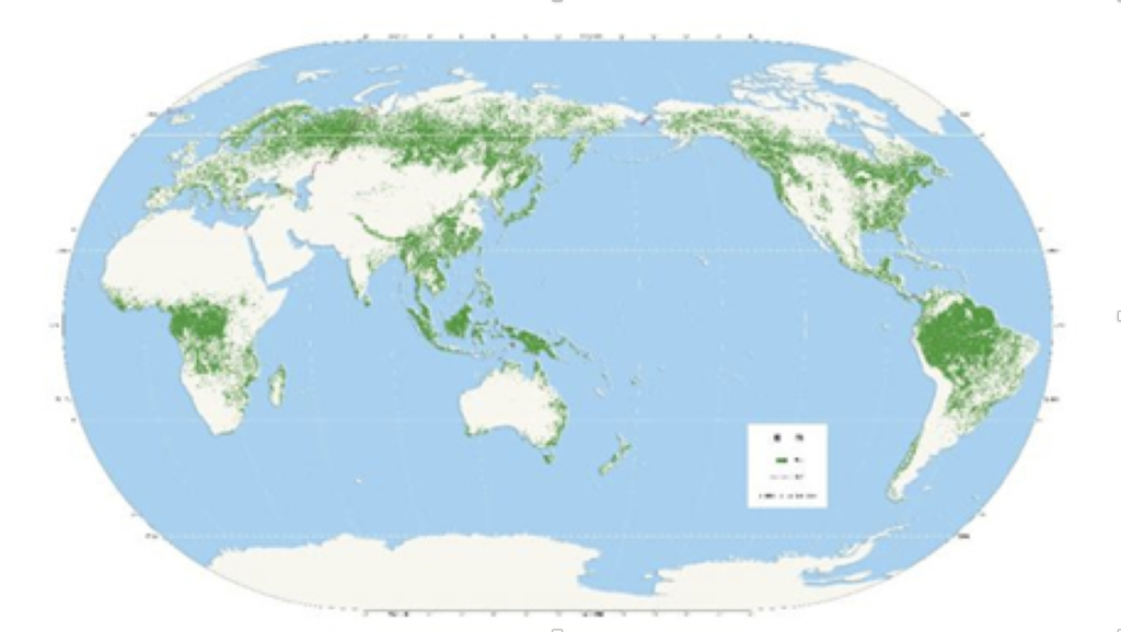
HE Guojin of the CAS Aerospace Information Innovation Research Institute has released a Global Forest Cover Map (GFCM) of 2018 at a 30-meter resolution. The map is based on Landsat satellite data and China-made high-resolution satellite data, using machine learning and big data analysis technology to achieve high-precision automatic extraction of global forest coverage. It correlates with the many goals of sustainable development in the UN 2030 Agenda.
CAS news release, Nov. 20, 2019